ZIP Code: 46530, Granger, IN
ZIP Code 46530 is located in Granger, Indiana. Its detail State, County, City, Longitude, Latitude, Envelope Example, Population is as below.

ZIP Code 46530 Information

-
-
Country:
U.S. - United States
State:
County FIPS:
18141
City:
Area Code:
City Type ?In many cases, a ZIP Code can have multiple "names", meaning cities, towns, or subdivisions, in its boundaries. However, it will ALWAYS have exactly 1 "default" name. D - Default - This is the "preferred" name - by the USPS - for a city. Each ZIP Code has one - and only one - "default" name. In most cases, this is what people who live in that area call the city as well. A - Acceptable - This name can be used for mailing purposes. Often times alternative names are large neighborhoods or sections of the city/town. In some cases a ZIP Code may have several "acceptable" names which is used to group towns under one ZIP Code. N - Not Acceptable - A "not acceptable" name is, in many cases, a nickname that residents give that location. According to the USPS, you should NOT send mail to that ZIP Code using the "not acceptable" name when mailing.:
D (Default)
ZIP Code:
46530
❓What does D (Default) mean? This is the "preferred" name - by the USPS - for a city. Each ZIP Code has one - and only one - "default" name. In most cases, this is what people who live in that area call the city as well.
ZIP Code 46530 Plus 4
ZIP Code 5 plus 4 is the extension of 5-digit zip code, It can be used to locate a more detailed location. The last four digits designate segment or one side of a street or an apartment. You can find the ZIP+4 code and corresponding address of the zip code 46530 below.
| ZIP Code 5 Plus 4 | Address |
|---|---|
| 46530-0001 | PO BOX 1, GRANGER, IN |
| 46530-0121 | PO BOX 121, GRANGER, IN |
| 46530-0201 | PO BOX 201, GRANGER, IN |
| 46530-0261 | PO BOX 261, GRANGER, IN |
| 46530-0361 | PO BOX 361, GRANGER, IN |
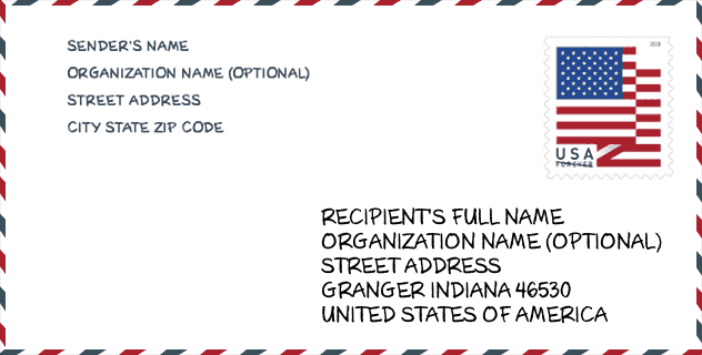
Envelope Example

This is an example of a US zip envelope. You can use a 5-digit zipcode or a detailed 9-digit zipcode to copy the mail in the following address format.
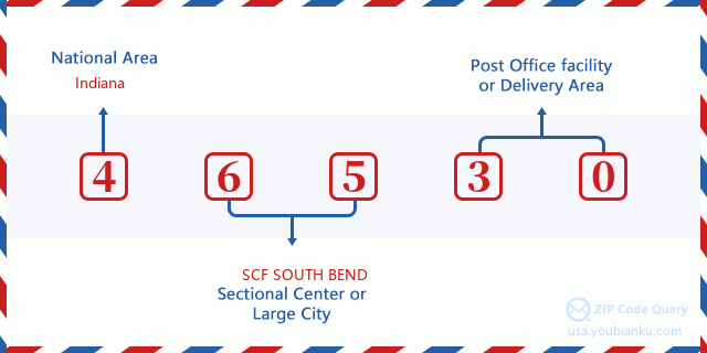
46530 Basic Meaning
What does each digit of ZIP Code 46530 stands for? The first digit designates a national area, which ranges from zero for the Northeast to nine for the far West. The 2-3 digits are the code of a sectional center facility in that region. The last two digits designate small post offices or postal zones.
Online Map

This is online map of the address Granger, Indiana, United States. You may use button to move and zoom in / out. The map information is for reference only.
University

This is the ZIP Code 46530 - University page list. Its detail university Name, Street, City, State, ZIP Code, Phone is as below.
| Name | Street | City | State | ZIP Code | Phone |
| Ross Medical Education Center-Granger | 445 E University Dr | Granger | IN | 46530 | (574) 273-4479 |
Library

This is the ZIP Code 46530 - Library page list. Its detail Library Name, Address, City, State, ZIP Code, Phone is as below.
- Name: HARRIS BRANCH LIBRARY
- Address: 51446 ELM ROAD
- City: GRANGER
- State: IN - Indiana
- ZIP Code: 46530
- Phone: (574) 259-5277
School
This is the ZIP Code 46530 - School page list. Its detail School Name, Address, City, State, ZIP Code is as below.
| School Name | Address | City | State | Grades | ZIP Code |
|---|---|---|---|---|---|
| Horizon Elementary School | 10060 Brummitt Rd | Granger | IN | UG | 46530 |
| Discovery Middle School | 10050 Brummitt Rd | Granger | IN | UG | 46530 |
| Northpoint Elementary School | 50800 Cherry Rd | Granger | IN | UG | 46530 |
| Mary Frank Harris Elementary Sch | 13111 Adams Rd | Granger | IN | UG | 46530 |
| Prairie Vista Elementary School | 15400 Brick Rd | Granger | IN | UG | 46530 |
Population for ZIP Code 46530

What is the total population in ZIP Code 46530? Below is detail information.
- Population for ZIP Code 46530: 33,960
- 2010 Population: 30,614
The 2020 demographic statistics are in progress. The current population in ZIP code 46530 is 33,960, and the population in 2010 is 30,614.
Gender

In all the statistical population, the male population is 15,182, the female population is 15,432.
- Male Population: 15,182
- Female Population: 15,432
Race

In all the statistical population, the male population is 15,182, the female population is 15,432.
- White Population: 28,134
- Black Population: 893
- Hispanic Population: 682
- Asian Population: 1,661
- Hawaiian Population: 53
- Indian Population: 158
- Other Population: 250
Age

In all the statistical population, the White population is 28,134, the Black population is 893, the Hispanic population is 682, the Asian population is 1,661, the Hawaiian population is 53, the Indian Ppopulation is 158 and Other population is 250.
- Age's Median: 39.9
- Median of male age: 39.7
- Median of female age: 40.0
Households for ZIP Code 46530
ZIP code 46530 has 10,665 households, with an average number of 2.87 persons per household. The average income per household in Zip code 46530 is 101,526 USD, and the average house value is 218,800 USD.
- Households Per Zipcode: 10,665
- Persons Per Household: 2.87
- Average House Value: 218,800
- Income Per Household: 101,526
Geographic

The latitude of the Zip code 46530 is 41.733676, the longitude is -86.122866, and the elevation is 791. It has land area of 24.883 square miles, and water area of 0.02 square miles. The time zone for ZIP code 46530 is Eastern (GMT -05:00). Daylight saving time should be observed in the area where the zip code is located.
- Latitude: 41.733676
- Longitude: -86.122866
- Elevation: 791
- Land Area: 24.883
- Water Area: 0.02
- Time Zone: Eastern (GMT -05:00)
- Region: Midwest
- Division: East North Central
- Day Light Saving: Y
Congressional District

The Congressional District for ZIP code 46530 is Indiana's 2nd congressional district, the Congressional Land Area is 3958.58 square mile.
- Congressional District: 2nd
- Congressional Land Area: 3958.58
Delivery

In the ZIP code 46530, there are 11,833 residential delivery mailboxes and centralized units, and 519 commercial delivery mailbox and centralized units, 10,389 single family deliveries and 983 multifamily deliveries, and the box count is 13,691. The main post office does not have city delivery carrier routes for the ZIP code 46530.
- Delivery Residential: 11,833
- Delivery Business: 519
- Delivery Total: 13,691
- Single Family Delivery Units: 10,389
- Multi Family Delivery Units: 983
- City Delivery Indicator: N
Business

In ZIP code 46530, the number of business is 604, the number of employee is 6,578, the business first quarter payroll is 54,994,000 USD, the business annual payroll is 225,104,000 USD.
- Number Of Businesses: 604
- Number Of Employees: 6,578
- Business First Quarter Payroll: 54,994,000
- Business Annual Payroll: 225,104,000
Social Security Benefits

There are 5,685 beneficiaries with benefits in current-payment status for ZIP code 46530, of which 4,545 are retired workers, 315 are disabled workers, 285 are widow(er)s and parents, 295 are spouses and 245 are children. The number of beneficiaries aged 65 or older is 4,905. The total monthly benefits are 9,623,000 USD, of which 8,120,000 USD for retired workers, 499,000 USD for widow(er)s and parents.
- Total Number: 5,685
- Retired workers Number: 4,545
- Disabled workers Number: 315
- Widow(er)s and parents Number: 285
- Spouses Number: 295
- Children Number: 245
- All beneficiaries per month: 9,623,000
- Retired workers per month: 8,120,000
- Widow(er)s and parents per month: 499,000
- Number of beneficiaries aged 65 or older: 4,905


Add new comment