Postcode: 48033, Southfield, MI
Postcode 48033 bevindt zich in Southfield, Michigan. Het detail staat, provincie, stad, lengtegraad, breedtegraad, envelop Voorbeeld, Bevolking is zoals hieronder.
Postcode 48033 Informatie

-
-
Land:
U.S. - Verenigde Staten
Staat:
Regio FIPS:
26125
Graafschap:
Stad:
Stadtype ?In many cases, a ZIP Code can have multiple "names", meaning cities, towns, or subdivisions, in its boundaries. However, it will ALWAYS have exactly 1 "default" name. D - Default - This is the "preferred" name - by the USPS - for a city. Each ZIP Code has one - and only one - "default" name. In most cases, this is what people who live in that area call the city as well. A - Acceptable - This name can be used for mailing purposes. Often times alternative names are large neighborhoods or sections of the city/town. In some cases a ZIP Code may have several "acceptable" names which is used to group towns under one ZIP Code. N - Not Acceptable - A "not acceptable" name is, in many cases, a nickname that residents give that location. According to the USPS, you should NOT send mail to that ZIP Code using the "not acceptable" name when mailing.:
D (Default)
Postcode:
48033
❓Wat betekent D (Default)? Dit is de "geprefereerde" naam - door de USPS - voor een stad. Elke postcode heeft één - en slechts één - "standaard" naam. In de meeste gevallen noemen mensen die in dat gebied wonen de stad ook.
Postcode 48033 Plus 4
ZIP Code 5 plus 4 is de uitbreiding van de 5-cijferige postcode, het kan worden gebruikt om een meer gedetailleerde locatie te vinden. De laatste vier cijfers duiden een segment of een kant van een straat of een appartement aan. Hieronder vindt u de postcode en het bijbehorende adres van de postcode 48033.
| Postcode 5 Plus 4 | Adres |
|---|---|
| 48033-0001 | PO BOX 33001, SOUTHFIELD, MI |
| 48033-0899 | 45101 JAMEARRE DR, SOUTHFIELD, MI |
| 48033-2103 | 22201 W 11 MILE RD, SOUTHFIELD, MI |
| 48033-2136 | 26701 NORTHWESTERN HWY, SOUTHFIELD, MI |
| 48033-2139 | 26711 NORTHWESTERN HWY, SOUTHFIELD, MI |
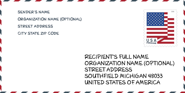
Envelop Voorbeeld

Dit is een voorbeeld van een Amerikaanse postenvelop. U kunt een 5-cijferige postcode of een gedetailleerde 9-cijferige postcode gebruiken om de mail in het volgende adresformaat te kopiëren.
48033 Basisbetekenis
Waar staat elk cijfer van postcode 48033 voor? Het eerste cijfer geeft een nationaal gebied aan, dat varieert van nul voor het noordoosten tot negen voor het verre westen. De 2-3 cijfers zijn de code van een sectiecentrumfaciliteit in die regio. De laatste twee cijfers duiden kleine postkantoren of postzones aan.

Online landkaart

Het is een online kaart van adres Southfield, Michigan, United States. U kunt Knopje gebruiken te in/uitzoomen. De kaartinformatie is alleen ter referentie.
Universiteit

This is the ZIP Code 48033 - University page list. Its detail university Name, Street, City, State, ZIP Code, Phone is as below.
| Naam | Straat | Stad | Staat | Postcode | Telefoon |
| Everest Institute-Southfield | 21107 Lahser Road | Southfield | MI | 48033 | - |
| Irene's Myomassology Institute | 26061 Franklin Road | Southfield | MI | 48033 | (248) 350-1400 |
| Specs Howard School of Media Arts | 26700 Lahser Road Suite 100 | Southfield | MI | 48033 | (248) 358-9000 |
Ziekenhuis

Het is de Postcode 48033 - Ziekenhuis pagina lijst. Het detail Ziekenhuisnaam, straat, stad, staat, postcode, telefoon is zoals hieronder.
- Naam: STRAITH HOSPITAL FOR SPECIAL SURGERY
- Adres: SOUTHFIELD
- Stad: 23901 LAHSER
- Staat: MI
- Postcode: 48033
- Telefoon: (248) 357-3360
Population for Postcode 48033

What is the total population in ZIP Code 48033? Below is detail information.
- Population for Postcode 48033: 17,449
- 2010 Bevolking: 16,064
The 2020 demographic statistics are in progress. The current population in ZIP code 48033 is 17,449, and the population in 2010 is 16,064.
Geslacht

In all the statistical population, the male population is 7,052, the female population is 9,012.
- Male Population: 7,052
- Female Population: 9,012
Race

In all the statistical population, the male population is 7,052, the female population is 9,012.
- White Population: 4,427
- Black Population: 11,573
- Hispanic Population: 215
- Asian Population: 205
- Hawaiian Population: 29
- Indian Population: 177
- Other Population: 102
Leeftijd

In all the statistical population, the White population is 4,427, the Black population is 11,573, the Hispanic population is 215, the Asian population is 205, the Hawaiian population is 29, the Indian Ppopulation is 177 and Other population is 102.
- Age's Median: 44.1
- Median of male age: 40.8
- Median of female age: 46.5
Households for Postcode 48033
ZIP code 48033 has 7,758 households, with an average number of 2.05 persons per household. The average income per household in Zip code 48033 is 49,845 USD, and the average house value is 127,500 USD.
- Households Per Zipcode: 7,758
- Personen per huishouden: 2.05
- Gemiddelde huiswaarde: 127,500
- Inkomen per huishouden: 49,845
Geographic

The latitude of the Zip code 48033 is 42.466061, the longitude is -83.288855, and the elevation is 675. It has land area of 8.964 square miles, and water area of 0.006 square miles. The time zone for ZIP code 48033 is Eastern (GMT -05:00). Daylight saving time should be observed in the area where the zip code is located.
- Breedtegraad: 42.466061
- Lengte: -83.288855
- Elevatie: 675
- Landoppervlak: 8.964
- Water Area: 0.006
- Tijd Zone: Eastern (GMT -05:00)
- Regio: Midwest
- Divisie: East North Central
- Zomertijd: Y
congresdistrict

The Congressional District for ZIP code 48033 is Michigan's 14th congressional district, the Congressional Land Area is 185.73 square mile.
- congresdistrict: 14th
- Congresgebied: 185.73
Levering

In the ZIP code 48033, there are 8,512 residential delivery mailboxes and centralized units, and 778 commercial delivery mailbox and centralized units, 3,949 single family deliveries and 2,710 multifamily deliveries, and the box count is 9,202. The main post office has city delivery carrier routes for the ZIP code 48033.
- Delivery Residential: 8,512
- Delivery Business: 778
- Delivery Total: 9,202
- Leveringseenheden voor één gezin: 3,949
- Multi Family Delivery Units: 2,710
- Stadsleveringsindicator: Y
Bedrijf

In ZIP code 48033, the number of business is 535, the number of employee is 16,050, the business first quarter payroll is 404,379,000 USD, the business annual payroll is 1,329,469,000 USD.
- Number Of Businesses: 535
- Number Of Employees: 16,050
- Zakelijke salarisadministratie eerste kwartaal: 404,379,000
- Zakelijke jaarlijkse loonlijst: 1,329,469,000
Sociale zekerheid

Er zijn 4,330 begunstigden met uitkeringen in de huidige betalingsstatus voor postcode 48033, waarvan 2,995 gepensioneerde werknemers, 670 gehandicapte werknemers, 270 weduwnaar (eren) en ouders, 100 zijn echtgenoten en 295 zijn kinderen. Het aantal begunstigden van 65 jaar of ouder is 3,185. De totale maandelijkse uitkeringen bedragen 6,558,000 USD, waarvan 4,947,000 USD voor gepensioneerde werknemers, 375,000 USD voor weduwnaar (eren) en ouders.
- Totaal aantal: 4,330
- Aantal gepensioneerden: 2,995
- Aantal gehandicapte werknemers: 670
- Weduwe / weduwnaar (er) en ouders Aantal: 270
- Echtgenoten nummer: 100
- Aantal kinderen: 295
- Alle begunstigden per maand: 6,558,000
- Gepensioneerde werknemers per maand: 4,947,000
- Weduwe (n) en ouders per maand: 375,000
- Aantal begunstigden van 65 jaar of ouder: 3,185


Reactie toevoegen