ZIP Code: 70119, New Orleans, LA
ZIP Code 70119 is located in New Orleans, Louisiana. Its detail State, County, City, Longitude, Latitude, Envelope Example, Population is as below.
ZIP Code 70119 Information

-
-
Country:
U.S. - United States
State:
County FIPS:
22071
County:
City:
Area Code:
City Type ?In many cases, a ZIP Code can have multiple "names", meaning cities, towns, or subdivisions, in its boundaries. However, it will ALWAYS have exactly 1 "default" name. D - Default - This is the "preferred" name - by the USPS - for a city. Each ZIP Code has one - and only one - "default" name. In most cases, this is what people who live in that area call the city as well. A - Acceptable - This name can be used for mailing purposes. Often times alternative names are large neighborhoods or sections of the city/town. In some cases a ZIP Code may have several "acceptable" names which is used to group towns under one ZIP Code. N - Not Acceptable - A "not acceptable" name is, in many cases, a nickname that residents give that location. According to the USPS, you should NOT send mail to that ZIP Code using the "not acceptable" name when mailing.:
D (Default)
ZIP Code:
70119
❓What does D (Default) mean? This is the "preferred" name - by the USPS - for a city. Each ZIP Code has one - and only one - "default" name. In most cases, this is what people who live in that area call the city as well.
ZIP Code 70119 Plus 4
ZIP Code 5 plus 4 is the extension of 5-digit zip code, It can be used to locate a more detailed location. The last four digits designate segment or one side of a street or an apartment. You can find the ZIP+4 code and corresponding address of the zip code 70119 below.
| ZIP Code 5 Plus 4 | Address |
|---|---|
| 70119-1001 | 1801 AGRICULTURE ST, NEW ORLEANS, LA |
| 70119-1002 | 1800 AGRICULTURE ST, NEW ORLEANS, LA |
| 70119-1003 | 1901 AGRICULTURE ST, NEW ORLEANS, LA |
| 70119-1004 | 1900 AGRICULTURE ST, NEW ORLEANS, LA |
| 70119-1007 | 1800 FLORIDA AVE, NEW ORLEANS, LA |
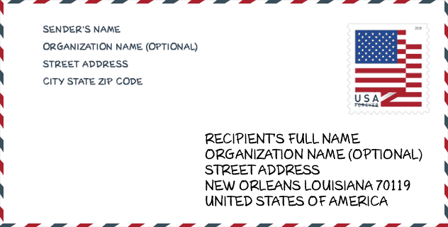
Envelope Example

This is an example of a US zip envelope. You can use a 5-digit zipcode or a detailed 9-digit zipcode to copy the mail in the following address format.
70119 Basic Meaning
What does each digit of ZIP Code 70119 stands for? The first digit designates a national area, which ranges from zero for the Northeast to nine for the far West. The 2-3 digits are the code of a sectional center facility in that region. The last two digits designate small post offices or postal zones.

Online Map

This is online map of the address New Orleans, Louisiana, United States. You may use button to move and zoom in / out. The map information is for reference only.
University

This is the ZIP Code 70119 - University page list. Its detail university Name, Street, City, State, ZIP Code, Phone is as below.
| Name | Street | City | State | ZIP Code | Phone |
| Cameron College | 2740 Canal St | New Orleans | LA | 70119 | - |
| Crescent City Bartending School | 209 N. Broad | New Orleans | LA | 70119 | (504) 822-3362 |
| Delgado Community College | 615 City Park Avenue | New Orleans | LA | 70119 | (504) 671-5000 |
Museum

This is the ZIP Code 70119 - Museum page list. Its detail Museum Name, Street, City, State, ZIP Code, Phone is as below.
| Name | Street | City | State | ZIP Code | Phone |
| SOUTHERN HISTORICAL RESEARCH AND RECOVERY ASSOCIATION | 3229 GRAND ROUTE SAINT JOHN | NEW ORLEANS | LA | 70119 | |
| ISAAC DELGADO FINE ARTS GALLERY | 615 CITY PARK AVE | NEW ORLEANS | LA | 70119 | (504) 671-6377 |
Library

This is the ZIP Code 70119 - Library page list. Its detail Library Name, Address, City, State, ZIP Code, Phone is as below.
- Name: MID-CITY BRANCH
- Address: 4140 CANAL STREET
- City: NEW ORLEANS
- State: LA - Louisiana
- ZIP Code: 70119
- Phone: (504) 596-2656
School
This is the ZIP Code 70119 - School page list. Its detail School Name, Address, City, State, ZIP Code is as below.
| School Name | Address | City | State | Grades | ZIP Code |
|---|---|---|---|---|---|
| Success Preparatory Academy | 4621 Canal Street | New Orleans | LA | UG | 70119 |
| Morris Jeff Community School | 211 Lopez Street | New Orleans | LA | UG | 70119 |
| Langston Hughes Charter Academy | 3519 Trafalgar Street | New Orleans | LA | UG | 70119 |
| Phillis Wheatley Community School | 2300 Dumaine St. | New Orleans | LA | UG | 70119 |
| McDonogh 42 Charter School | 1651 N Tonti Street | New Orleans | LA | UG | 70119 |
| Bricolage Academy | 2426 Esplanade | New Orleans | LA | UG | 70119 |
| Warren Easton Charter High School | 3019 CANAL STREET | NEW ORLEANS | LA | UG | 70119 |
| Esperanza Charter School | 4407 S CARROLLTON AVE | NEW ORLEANS | LA | UG | 70119 |
Population for ZIP Code 70119

What is the total population in ZIP Code 70119? Below is detail information.
- Population for ZIP Code 70119: 45,100
- 2010 Population: 36,228
The 2020 demographic statistics are in progress. The current population in ZIP code 70119 is 45,100, and the population in 2010 is 36,228.
Gender

In all the statistical population, the male population is 19,137, the female population is 17,091.
- Male Population: 19,137
- Female Population: 17,091
Race

In all the statistical population, the male population is 19,137, the female population is 17,091.
- White Population: 11,979
- Black Population: 22,715
- Hispanic Population: 3,407
- Asian Population: 390
- Hawaiian Population: 32
- Indian Population: 305
- Other Population: 1,629
Age

In all the statistical population, the White population is 11,979, the Black population is 22,715, the Hispanic population is 3,407, the Asian population is 390, the Hawaiian population is 32, the Indian Ppopulation is 305 and Other population is 1,629.
- Age's Median: 34.2
- Median of male age: 33.6
- Median of female age: 35.0
Households for ZIP Code 70119
ZIP code 70119 has 14,939 households, with an average number of 2.16 persons per household. The average income per household in Zip code 70119 is 36,785 USD, and the average house value is 255,200 USD.
- Households Per Zipcode: 14,939
- Persons Per Household: 2.16
- Average House Value: 255,200
- Income Per Household: 36,785
Housing Unit

In ZIP code 70119, the growth rank of housing unit is 9, the number of housing unit was 343,829 in 2010 and increased to 360,740 in 2011, the growth increase number is 16,911, the growth increase percentage is 4.9%.
- Growth Rank: 9
- Housing Units Estimate in 2010: 343,829
- Housing Units Estimate in 2011: 360,740
- Growth Increase Number: 16,911
- Growth Increase Percentage: 4.9%
Geographic

The latitude of the Zip code 70119 is 29.973581, the longitude is -90.085678, and the elevation is 0. It has land area of 4.471 square miles, and water area of 0.034 square miles. The time zone for ZIP code 70119 is Central (GMT -06:00). Daylight saving time should be observed in the area where the zip code is located.
- Latitude: 29.973581
- Longitude: -90.085678
- Elevation: 0
- Land Area: 4.471
- Water Area: 0.034
- Time Zone: Central (GMT -06:00)
- Region: South
- Division: West South Central
- Day Light Saving: Y
Congressional District

The Congressional District for ZIP code 70119 is Louisiana's 1st|2nd congressional district, the Congressional Land Area is 4030.23|1268.48 square mile.
- Congressional District: 1st|2nd
- Congressional Land Area: 4030.23|1268.48
Delivery

In the ZIP code 70119, there are 20,880 residential delivery mailboxes and centralized units, and 1,861 commercial delivery mailbox and centralized units, 15,792 single family deliveries and 3,124 multifamily deliveries, and the box count is 22,797. The main post office has city delivery carrier routes for the ZIP code 70119.
- Delivery Residential: 20,880
- Delivery Business: 1,861
- Delivery Total: 22,797
- Single Family Delivery Units: 15,792
- Multi Family Delivery Units: 3,124
- City Delivery Indicator: Y
Business

In ZIP code 70119, the number of business is 1,016, the number of employee is 17,689, the business first quarter payroll is 205,428,000 USD, the business annual payroll is 832,793,000 USD.
- Number Of Businesses: 1,016
- Number Of Employees: 17,689
- Business First Quarter Payroll: 205,428,000
- Business Annual Payroll: 832,793,000
Social Security Benefits

There are 5,770 beneficiaries with benefits in current-payment status for ZIP code 70119, of which 3,615 are retired workers, 1,145 are disabled workers, 400 are widow(er)s and parents, 140 are spouses and 470 are children. The number of beneficiaries aged 65 or older is 3,900. The total monthly benefits are 6,388,000 USD, of which 4,411,000 USD for retired workers, 442,000 USD for widow(er)s and parents.
- Total Number: 5,770
- Retired workers Number: 3,615
- Disabled workers Number: 1,145
- Widow(er)s and parents Number: 400
- Spouses Number: 140
- Children Number: 470
- All beneficiaries per month: 6,388,000
- Retired workers per month: 4,411,000
- Widow(er)s and parents per month: 442,000
- Number of beneficiaries aged 65 or older: 3,900


Add new comment