ZIP Code: 70774, Saint Amant, LA
ZIP Code 70774 is located in Saint Amant, Louisiana. Its detail State, County, City, Longitude, Latitude, Envelope Example, Population is as below.

ZIP Code 70774 Information

-
-
Country:
U.S. - United States
State:
County FIPS:
22005
City:
Area Code:
City Type ?In many cases, a ZIP Code can have multiple "names", meaning cities, towns, or subdivisions, in its boundaries. However, it will ALWAYS have exactly 1 "default" name. D - Default - This is the "preferred" name - by the USPS - for a city. Each ZIP Code has one - and only one - "default" name. In most cases, this is what people who live in that area call the city as well. A - Acceptable - This name can be used for mailing purposes. Often times alternative names are large neighborhoods or sections of the city/town. In some cases a ZIP Code may have several "acceptable" names which is used to group towns under one ZIP Code. N - Not Acceptable - A "not acceptable" name is, in many cases, a nickname that residents give that location. According to the USPS, you should NOT send mail to that ZIP Code using the "not acceptable" name when mailing.:
D (Default)
ZIP Code:
70774
❓What does D (Default) mean? This is the "preferred" name - by the USPS - for a city. Each ZIP Code has one - and only one - "default" name. In most cases, this is what people who live in that area call the city as well.
ZIP Code 70774 Plus 4
ZIP Code 5 plus 4 is the extension of 5-digit zip code, It can be used to locate a more detailed location. The last four digits designate segment or one side of a street or an apartment. You can find the ZIP+4 code and corresponding address of the zip code 70774 below.
| ZIP Code 5 Plus 4 | Address |
|---|---|
| 70774-0001 | PO BOX 1, SAINT AMANT, LA |
| 70774-0121 | PO BOX 121, SAINT AMANT, LA |
| 70774-0241 | PO BOX 241, SAINT AMANT, LA |
| 70774-0361 | PO BOX 361, SAINT AMANT, LA |
| 70774-0481 | PO BOX 481, SAINT AMANT, LA |
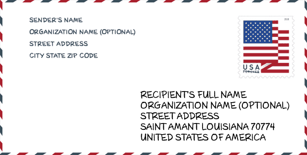
Envelope Example

This is an example of a US zip envelope. You can use a 5-digit zipcode or a detailed 9-digit zipcode to copy the mail in the following address format.
70774 Basic Meaning
What does each digit of ZIP Code 70774 stands for? The first digit designates a national area, which ranges from zero for the Northeast to nine for the far West. The 2-3 digits are the code of a sectional center facility in that region. The last two digits designate small post offices or postal zones.

Online Map

This is online map of the address Saint Amant, Louisiana, United States. You may use button to move and zoom in / out. The map information is for reference only.
School

This is the ZIP Code 70774 - School page list. Its detail School Name, Address, City, State, ZIP Code is as below.
| School Name | Address | City | State | Grades | ZIP Code |
|---|---|---|---|---|---|
| St. Amant Middle School | 44317 Hwy 429 | St. Amant | LA | UG | 70774 |
| St. Amant High School | 12035 Hwy 431 | St. Amant | LA | UG | 70774 |
| Lake Elementary School | 14185 Hwy 431 | St. Amant | LA | UG | 70774 |
| St. Amant Primary School | 44365 Hwy 429 | St. Amant | LA | UG | 70774 |
Population for ZIP Code 70774

What is the total population in ZIP Code 70774? Below is detail information.
- Population for ZIP Code 70774: 10,825
- 2010 Population: 10,076
The 2020 demographic statistics are in progress. The current population in ZIP code 70774 is 10,825, and the population in 2010 is 10,076.
Gender

In all the statistical population, the male population is 5,047, the female population is 5,029.
- Male Population: 5,047
- Female Population: 5,029
Race

In all the statistical population, the male population is 5,047, the female population is 5,029.
- White Population: 9,839
- Black Population: 122
- Hispanic Population: 203
- Asian Population: 53
- Hawaiian Population: 9
- Indian Population: 81
- Other Population: 87
Age

In all the statistical population, the White population is 9,839, the Black population is 122, the Hispanic population is 203, the Asian population is 53, the Hawaiian population is 9, the Indian Ppopulation is 81 and Other population is 87.
- Age's Median: 36.7
- Median of male age: 36.0
- Median of female age: 37.1
Households for ZIP Code 70774
ZIP code 70774 has 3,705 households, with an average number of 2.72 persons per household. The average income per household in Zip code 70774 is 81,426 USD, and the average house value is 161,200 USD.
- Households Per Zipcode: 3,705
- Persons Per Household: 2.72
- Average House Value: 161,200
- Income Per Household: 81,426
Housing Unit

In ZIP code 70774, the growth rank of housing unit is 81, the number of housing unit was 107,169 in 2010 and increased to 109,985 in 2011, the growth increase number is 2,816, the growth increase percentage is 2.6%.
- Growth Rank: 81
- Housing Units Estimate in 2010: 107,169
- Housing Units Estimate in 2011: 109,985
- Growth Increase Number: 2,816
- Growth Increase Percentage: 2.6%
Geographic

The latitude of the Zip code 70774 is 30.209048, the longitude is -90.754663, and the elevation is 1. It has land area of 75.972 square miles, and water area of 1.687 square miles. The time zone for ZIP code 70774 is Central (GMT -06:00). Daylight saving time should be observed in the area where the zip code is located.
- Latitude: 30.209048
- Longitude: -90.754663
- Elevation: 1
- Land Area: 75.972
- Water Area: 1.687
- Time Zone: Central (GMT -06:00)
- Region: South
- Division: West South Central
- Day Light Saving: Y
Congressional District

The Congressional District for ZIP code 70774 is Louisiana's 06th congressional district, the Congressional Land Area is 4033.89 square mile.
- Congressional District: 06th
- Congressional Land Area: 4033.89
Delivery

In the ZIP code 70774, there are 3,980 residential delivery mailboxes and centralized units, and 87 commercial delivery mailbox and centralized units, 3,762 single family deliveries and 0 multifamily deliveries, and the box count is 4,424. The main post office does not have city delivery carrier routes for the ZIP code 70774.
- Delivery Residential: 3,980
- Delivery Business: 87
- Delivery Total: 4,424
- Single Family Delivery Units: 3,762
- Multi Family Delivery Units: 0
- City Delivery Indicator: N
Business

In ZIP code 70774, the number of business is 95, the number of employee is 950, the business first quarter payroll is 8,546,000 USD, the business annual payroll is 32,217,000 USD.
- Number Of Businesses: 95
- Number Of Employees: 950
- Business First Quarter Payroll: 8,546,000
- Business Annual Payroll: 32,217,000
Social Security Benefits

There are 1,900 beneficiaries with benefits in current-payment status for ZIP code 70774, of which 1,185 are retired workers, 240 are disabled workers, 180 are widow(er)s and parents, 160 are spouses and 135 are children. The number of beneficiaries aged 65 or older is 1,395. The total monthly benefits are 2,719,000 USD, of which 1,855,000 USD for retired workers, 260,000 USD for widow(er)s and parents.
- Total Number: 1,900
- Retired workers Number: 1,185
- Disabled workers Number: 240
- Widow(er)s and parents Number: 180
- Spouses Number: 160
- Children Number: 135
- All beneficiaries per month: 2,719,000
- Retired workers per month: 1,855,000
- Widow(er)s and parents per month: 260,000
- Number of beneficiaries aged 65 or older: 1,395


Add new comment