Postcode: 46320, Hammond, IN
Postcode 46320 bevindt zich in Hammond, Indiana. Het detail staat, provincie, stad, lengtegraad, breedtegraad, envelop Voorbeeld, Bevolking is zoals hieronder.
Postcode 46320 Informatie

-
-
Land:
U.S. - Verenigde Staten
Staat:
Regio FIPS:
18089
Graafschap:
Stad:
Netnummer:
Stadtype ?In many cases, a ZIP Code can have multiple "names", meaning cities, towns, or subdivisions, in its boundaries. However, it will ALWAYS have exactly 1 "default" name. D - Default - This is the "preferred" name - by the USPS - for a city. Each ZIP Code has one - and only one - "default" name. In most cases, this is what people who live in that area call the city as well. A - Acceptable - This name can be used for mailing purposes. Often times alternative names are large neighborhoods or sections of the city/town. In some cases a ZIP Code may have several "acceptable" names which is used to group towns under one ZIP Code. N - Not Acceptable - A "not acceptable" name is, in many cases, a nickname that residents give that location. According to the USPS, you should NOT send mail to that ZIP Code using the "not acceptable" name when mailing.:
D (Default)
Postcode:
46320
❓Wat betekent D (Default)? Dit is de "geprefereerde" naam - door de USPS - voor een stad. Elke postcode heeft één - en slechts één - "standaard" naam. In de meeste gevallen noemen mensen die in dat gebied wonen de stad ook.
Postcode 46320 Plus 4
ZIP Code 5 plus 4 is de uitbreiding van de 5-cijferige postcode, het kan worden gebruikt om een meer gedetailleerde locatie te vinden. De laatste vier cijfers duiden een segment of een kant van een straat of een appartement aan. Hieronder vindt u de postcode en het bijbehorende adres van de postcode 46320.
| Postcode 5 Plus 4 | Adres |
|---|---|
| 46320-1000 | 801 CASINO CENTER DR, HAMMOND, IN |
| 46320-1001 | 901 CASINO CENTER DR, HAMMOND, IN |
| 46320-1003 | 701 CASINO CENTER DR, HAMMOND, IN |
| 46320-1007 | 1000 CALUMET AVE, HAMMOND, IN |
| 46320-1012 | 240 112TH ST, HAMMOND, IN |
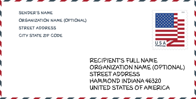
Envelop Voorbeeld

Dit is een voorbeeld van een Amerikaanse postenvelop. U kunt een 5-cijferige postcode of een gedetailleerde 9-cijferige postcode gebruiken om de mail in het volgende adresformaat te kopiëren.
46320 Basisbetekenis
Waar staat elk cijfer van postcode 46320 voor? Het eerste cijfer geeft een nationaal gebied aan, dat varieert van nul voor het noordoosten tot negen voor het verre westen. De 2-3 cijfers zijn de code van een sectiecentrumfaciliteit in die regio. De laatste twee cijfers duiden kleine postkantoren of postzones aan.

Online landkaart

Het is een online kaart van adres Hammond, Indiana, United States. U kunt Knopje gebruiken te in/uitzoomen. De kaartinformatie is alleen ter referentie.
Ziekenhuis

Het is de Postcode 46320 - Ziekenhuis pagina lijst. Het detail Ziekenhuisnaam, straat, stad, staat, postcode, telefoon is zoals hieronder.
- Naam: FRANCISCAN ST. MARGARET HEALTH HAMMOND
- Adres: HAMMOND
- Stad: 5454 HOHMAN AVE
- Staat: IN
- Postcode: 46320
- Telefoon: (219) 932-2300
Bibliotheek

Dit is de paginalijst van Postcode 46320 - Bibliotheek. Hieronder is het detail van Bibliotheek Naam, Adres, Stad, Staat, Postcode, Telefoon.
- Naam: HAMMOND PUBLIC LIBRARY
- Adres: 564 STATE STREET
- Stad: HAMMOND
- Staat: IN - Indiana
- Postcode: 46320
- Telefoon: (219) 931-5100
School

Dit is de paginalijst van Postcode 46320 - School. Hieronder is het detail van School Naam, Adres, Stad, Staat, Postcode.
| School Naam | Adres | Stad | Staat | Klassen | Postcode |
|---|---|---|---|---|---|
| Hammond Academy of Science & Tech | 33 Muenich Ct | Hammond | IN | UG | 46320 |
| Hammond Central High School | 5926 Calumet Ave | Hammond | IN | UG | 46320 |
| Area Career Center | 5727 Sohl Ave | Hammond | IN | UG | 46320 |
| Henry W Eggers Middle School | 5825 Blaine Ave | Hammond | IN | UG | 46320 |
Population for Postcode 46320

What is the total population in ZIP Code 46320? Below is detail information.
- Population for Postcode 46320: 13,437
- 2010 Bevolking: 15,508
The 2020 demographic statistics are in progress. The current population in ZIP code 46320 is 13,437, and the population in 2010 is 15,508.
Geslacht

In all the statistical population, the male population is 7,461, the female population is 8,047.
- Male Population: 7,461
- Female Population: 8,047
Race

In all the statistical population, the male population is 7,461, the female population is 8,047.
- White Population: 5,565
- Black Population: 8,039
- Hispanic Population: 4,591
- Asian Population: 66
- Hawaiian Population: 22
- Indian Population: 177
- Other Population: 2,171
Leeftijd

In all the statistical population, the White population is 5,565, the Black population is 8,039, the Hispanic population is 4,591, the Asian population is 66, the Hawaiian population is 22, the Indian Ppopulation is 177 and Other population is 2,171.
- Age's Median: 31.1
- Median of male age: 30.4
- Median of female age: 31.7
Households for Postcode 46320
ZIP code 46320 has 5,780 households, with an average number of 2.64 persons per household. The average income per household in Zip code 46320 is 30,439 USD, and the average house value is 71,400 USD.
- Households Per Zipcode: 5,780
- Personen per huishouden: 2.64
- Gemiddelde huiswaarde: 71,400
- Inkomen per huishouden: 30,439
Geographic

The latitude of the Zip code 46320 is 41.650963, the longitude is -87.493501, and the elevation is 586. It has land area of 6.678 square miles, and water area of 1.774 square miles. The time zone for ZIP code 46320 is Central (GMT -06:00). Daylight saving time should be observed in the area where the zip code is located.
- Breedtegraad: 41.650963
- Lengte: -87.493501
- Elevatie: 586
- Landoppervlak: 6.678
- Water Area: 1.774
- Tijd Zone: Central (GMT -06:00)
- Regio: Midwest
- Divisie: East North Central
- Zomertijd: Y
congresdistrict

The Congressional District for ZIP code 46320 is Indiana's 1st congressional district, the Congressional Land Area is 1157.02 square mile.
- congresdistrict: 1st
- Congresgebied: 1157.02
Levering

In the ZIP code 46320, there are 5,090 residential delivery mailboxes and centralized units, and 516 commercial delivery mailbox and centralized units, 3,591 single family deliveries and 1,439 multifamily deliveries, and the box count is 6,931. The main post office has city delivery carrier routes for the ZIP code 46320.
- Delivery Residential: 5,090
- Delivery Business: 516
- Delivery Total: 6,931
- Leveringseenheden voor één gezin: 3,591
- Multi Family Delivery Units: 1,439
- Stadsleveringsindicator: Y
Bedrijf

In ZIP code 46320, the number of business is 362, the number of employee is 11,002, the business first quarter payroll is 123,421,000 USD, the business annual payroll is 491,230,000 USD.
- Number Of Businesses: 362
- Number Of Employees: 11,002
- Zakelijke salarisadministratie eerste kwartaal: 123,421,000
- Zakelijke jaarlijkse loonlijst: 491,230,000
Sociale zekerheid

Er zijn 2,385 begunstigden met uitkeringen in de huidige betalingsstatus voor postcode 46320, waarvan 1,220 gepensioneerde werknemers, 630 gehandicapte werknemers, 205 weduwnaar (eren) en ouders, 75 zijn echtgenoten en 255 zijn kinderen. Het aantal begunstigden van 65 jaar of ouder is 1,375. De totale maandelijkse uitkeringen bedragen 2,806,000 USD, waarvan 1,627,000 USD voor gepensioneerde werknemers, 259,000 USD voor weduwnaar (eren) en ouders.
- Totaal aantal: 2,385
- Aantal gepensioneerden: 1,220
- Aantal gehandicapte werknemers: 630
- Weduwe / weduwnaar (er) en ouders Aantal: 205
- Echtgenoten nummer: 75
- Aantal kinderen: 255
- Alle begunstigden per maand: 2,806,000
- Gepensioneerde werknemers per maand: 1,627,000
- Weduwe (n) en ouders per maand: 259,000
- Aantal begunstigden van 65 jaar of ouder: 1,375


Reactie toevoegen