United States ZIP Code: 20373
This is the District of Columbia ZIP Code 20373 page list. Its detail State, County, City/Agency, Longitude, Latitude, Envelope Example, Population is as below.

ZIP Code 20373 Information

-
-
Country:
U.S. - United States
State FIPS:
11
Area Code:
ZIP Code:
20373
ZIP Type:
U (Unique)
❓What does U (Unique) mean? Companies, organizations, and institutions that receive large quantities of mail are given a "unique" ZIP Code type.
ZIP Code 20373 - City/Agency

This is the city information corresponding to 20373:
| State | County | City/Agency | City Type ?In many cases, a ZIP Code can have multiple "names", meaning cities, towns, or subdivisions, in its boundaries. However, it will ALWAYS have exactly 1 "default" name. D - Default - This is the "preferred" name - by the USPS - for a city. Each ZIP Code has one - and only one - "default" name. In most cases, this is what people who live in that area call the city as well. A - Acceptable - This name can be used for mailing purposes. Often times alternative names are large neighborhoods or sections of the city/town. In some cases a ZIP Code may have several "acceptable" names which is used to group towns under one ZIP Code. N - Not Acceptable - A "not acceptable" name is, in many cases, a nickname that residents give that location. According to the USPS, you should NOT send mail to that ZIP Code using the "not acceptable" name when mailing. | ZIP Code |
|---|---|---|---|---|
| DC | District Of Columbia | Anacostia | A (Acceptable) | 20373 |
| DC | District Of Columbia | Anacostia Anx | A (Acceptable) | 20373 |
| DC | District Of Columbia | Jbab | A (Acceptable) | 20373 |
| DC | District Of Columbia | Joint Base Anacostia Bolling | A (Acceptable) | 20373 |
| DC | District Of Columbia | Naval Anacost Annex | D (Default) | 20373 |
| DC | District Of Columbia | Naval Station Anacostia | N (Not Acceptable) | 20373 |
| DC | District Of Columbia | Washington | A (Acceptable) | 20373 |
❓What does D (Default) mean? This is the "preferred" name - by the USPS - for a city. Each ZIP Code has one - and only one - "default" name. In most cases, this is what people who live in that area call the city as well.
❓What does A (Acceptable) mean? This name can be used for mailing purposes. Often times alternative names are large neighborhoods or sections of the city/town. In some cases a ZIP Code may have several "acceptable" names which is used to group towns under one ZIP Code.
❓What does N (Not Acceptable) mean? A "not acceptable" name is, in many cases, a nickname that residents give that location. According to the USPS, you should NOT send mail to that ZIP Code using the "not acceptable" name when mailing.
ZIP Code 20373 Plus 4
ZIP Code 5 plus 4 is the extension of 5-digit zip code, It can be used to locate a more detailed location. The last four digits designate segment or one side of a street or an apartment. You can find the ZIP+4 code and corresponding address of the zip code 20373 below.
| ZIP Code 5 Plus 4 | Address |
|---|---|
| 20373-0001 | 2701 S CAPITOL ST, NAVAL ANACOST ANNEX, DC |
| 20373-0300 | 190 POREMBA CT, NAVAL ANACOST ANNEX, DC |
| 20373-0301 | 183 SPRUANCE CIR, NAVAL ANACOST ANNEX, DC |
| 20373-0340 | 2822 DOHERTY DR, NAVAL ANACOST ANNEX, DC |
| 20373-5100 | 2812 ROBBINS RD, NAVAL ANACOST ANNEX, DC |
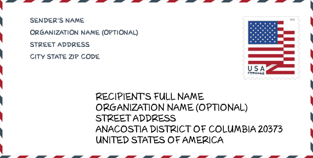
Envelope Example

This is an example of a US zip envelope. You can use a 5-digit zipcode or a detailed 9-digit zipcode to copy the mail in the following address format.
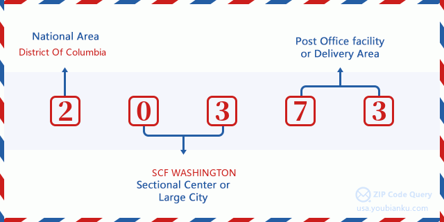
20373 Basic Meaning
What does each digit of ZIP Code 20373 stands for? The first digit designates a national area, which ranges from zero for the Northeast to nine for the far West. The 2-3 digits are the code of a sectional center facility in that region. The last two digits designate small post offices or postal zones.
Online Map

This is online map of the address Washington, District of Columbia, United States. You may use button to move and zoom in / out. The map information is for reference only.
Gender

In all the statistical population, the male population is 113, the female population is 18.
- Male Population: 113
- Female Population: 18
Race

In all the statistical population, the male population is 113, the female population is 18.
- White Population: 84
- Black Population: 34
- Hispanic Population: 17
- Asian Population: 8
- Hawaiian Population: 1
- Indian Population: 2
- Other Population: 4
Age

In all the statistical population, the White population is 84, the Black population is 34, the Hispanic population is 17, the Asian population is 8, the Hawaiian population is 1, the Indian Ppopulation is 2 and Other population is 4.
- Age's Median: 24.3
- Median of male age: 24.5
- Median of female age: 23.0
Households for ZIP Code 20373
ZIP code 20373 has 0 households, with an average number of 0.00 persons per household. The average income per household in Zip code 20373 is 0 USD, and the average house value is 0 USD.
- Households Per Zipcode: 0
- Persons Per Household: 0.00
- Average House Value: 0
- Income Per Household: 0
Housing Unit

In ZIP code 20373, the growth rank of housing unit is 75, the number of housing unit was 601,723 in 2010 and increased to 617,996 in 2011, the growth increase number is 16,273, the growth increase percentage is 2.7%.
- Growth Rank: 75
- Housing Units Estimate in 2010: 601,723
- Housing Units Estimate in 2011: 617,996
- Growth Increase Number: 16,273
- Growth Increase Percentage: 2.7%
Geographic

The latitude of the Zip code 20373 is 38.895100, the longitude is -77.036900, and the elevation is 23. It has land area of 0.363 square miles, and water area of 0.001 square miles. The time zone for ZIP code 20373 is Eastern (GMT -05:00). Daylight saving time should be observed in the area where the zip code is located.
- Latitude: 38.895100
- Longitude: -77.036900
- Elevation: 23
- Land Area: 0.363
- Water Area: 0.001
- Time Zone: Eastern (GMT -05:00)
- Region: South
- Division: South Atlantic
- Day Light Saving: Y
Congressional District

The Congressional District for ZIP code 20373 is District of Columbia's 98th congressional district, the Congressional Land Area is 61.40 square mile.
- Congressional District: 98th
- Congressional Land Area: 61.40
Delivery

In the ZIP code 20373, there are 0 residential delivery mailboxes and centralized units, and 1 commercial delivery mailbox and centralized units, 0 single family deliveries and 0 multifamily deliveries, and the box count is 1. The main post office does not have city delivery carrier routes for the ZIP code 20373.
- Delivery Residential: 0
- Delivery Business: 1
- Delivery Total: 1
- Single Family Delivery Units: 0
- Multi Family Delivery Units: 0
- City Delivery Indicator: N
Business

In ZIP code 20373, the number of business is 9, the number of employee is 95, the business first quarter payroll is 2,388,000 USD, the business annual payroll is 9,564,000 USD.
- Number Of Businesses: 9
- Number Of Employees: 95
- Business First Quarter Payroll: 2,388,000
- Business Annual Payroll: 9,564,000


Add new comment