ZIP Code: 78642, Liberty Hill, TX
ZIP Code 78642 is located in Liberty Hill, Texas. Its detail State, County, City, Longitude, Latitude, Envelope Example, Population is as below.

ZIP Code 78642 Information

-
-
Country:
U.S. - United States
State:
County FIPS:
48491
City:
City Type ?In many cases, a ZIP Code can have multiple "names", meaning cities, towns, or subdivisions, in its boundaries. However, it will ALWAYS have exactly 1 "default" name. D - Default - This is the "preferred" name - by the USPS - for a city. Each ZIP Code has one - and only one - "default" name. In most cases, this is what people who live in that area call the city as well. A - Acceptable - This name can be used for mailing purposes. Often times alternative names are large neighborhoods or sections of the city/town. In some cases a ZIP Code may have several "acceptable" names which is used to group towns under one ZIP Code. N - Not Acceptable - A "not acceptable" name is, in many cases, a nickname that residents give that location. According to the USPS, you should NOT send mail to that ZIP Code using the "not acceptable" name when mailing.:
D (Default)
ZIP Code:
78642
❓What does D (Default) mean? This is the "preferred" name - by the USPS - for a city. Each ZIP Code has one - and only one - "default" name. In most cases, this is what people who live in that area call the city as well.
ZIP Code 78642 Plus 4
ZIP Code 5 plus 4 is the extension of 5-digit zip code, It can be used to locate a more detailed location. The last four digits designate segment or one side of a street or an apartment. You can find the ZIP+4 code and corresponding address of the zip code 78642 below.
| ZIP Code 5 Plus 4 | Address |
|---|---|
| 78642-0001 | PO BOX 1, LIBERTY HILL, TX |
| 78642-0009 | 100 TIMBER WOLF TRCE, LIBERTY HILL, TX |
| 78642-0010 | PO BOX 10, LIBERTY HILL, TX |
| 78642-0121 | PO BOX 121, LIBERTY HILL, TX |
| 78642-0199 | 29901 PLARANIN, LIBERTY HILL, TX |
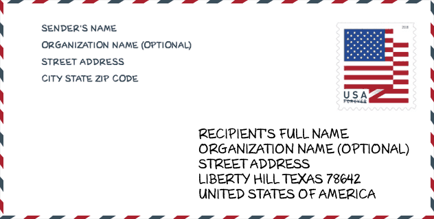
Envelope Example

This is an example of a US zip envelope. You can use a 5-digit zipcode or a detailed 9-digit zipcode to copy the mail in the following address format.
78642 Basic Meaning
What does each digit of ZIP Code 78642 stands for? The first digit designates a national area, which ranges from zero for the Northeast to nine for the far West. The 2-3 digits are the code of a sectional center facility in that region. The last two digits designate small post offices or postal zones.

Online Map

This is online map of the address Liberty Hill, Texas, United States. You may use button to move and zoom in / out. The map information is for reference only.
Library

This is the ZIP Code 78642 - Library page list. Its detail Library Name, Address, City, State, ZIP Code, Phone is as below.
- Name: LIBERTY HILL PUBLIC LIBRARY
- Address: 355 LOOP 332
- City: LIBERTY HILL
- State: TX - Texas
- ZIP Code: 78642
- Phone: (512) 778-6400
School

This is the ZIP Code 78642 - School page list. Its detail School Name, Address, City, State, ZIP Code is as below.
| School Name | Address | City | State | Grades | ZIP Code |
|---|---|---|---|---|---|
| KI CHARTER ACADEMY LIBERTY HILL | 12550 HWY 29 | LIBERTY HILL | TX | UG | 78642 |
| LIBERTY HILL EL | 1400 LOOP 332 | LIBERTY HILL | TX | UG | 78642 |
| LIBERTY HILL H S | 16500 W STATE HWY 29 | LIBERTY HILL | TX | UG | 78642 |
| LIBERTY HILL MIDDLE | 13125 W STATE HWY 29 | LIBERTY HILL | TX | UG | 78642 |
| LOUINE NOBLE EL | 101 LOOP 332 | LIBERTY HILL | TX | UG | 78642 |
| BILL BURDEN EL | 315 STONEWALL PKWY | LIBERTY HILL | TX | UG | 78642 |
| SANTA RITA EL | 532 SANTA RITA BLVD | LIBERTY HILL | TX | UG | 78642 |
| SANTA RITA MIDDLE | 90 E SANTA RITA BLVD | LIBERTY HILL | TX | UG | 78642 |
| NEW EL BAR W | 301 FORREST ST | LIBERTY HILL | TX | UG | 78642 |
Population for ZIP Code 78642

What is the total population in ZIP Code 78642? Below is detail information.
- Population for ZIP Code 78642: 21,117
- 2010 Population: 9,467
The 2020 demographic statistics are in progress. The current population in ZIP code 78642 is 21,117, and the population in 2010 is 9,467.
Gender

In all the statistical population, the male population is 4,763, the female population is 4,704.
- Male Population: 4,763
- Female Population: 4,704
Race

In all the statistical population, the male population is 4,763, the female population is 4,704.
- White Population: 8,708
- Black Population: 147
- Hispanic Population: 1,333
- Asian Population: 84
- Hawaiian Population: 17
- Indian Population: 123
- Other Population: 592
Age

In all the statistical population, the White population is 8,708, the Black population is 147, the Hispanic population is 1,333, the Asian population is 84, the Hawaiian population is 17, the Indian Ppopulation is 123 and Other population is 592.
- Age's Median: 38.9
- Median of male age: 38.7
- Median of female age: 39.0
Households for ZIP Code 78642
ZIP code 78642 has 3,227 households, with an average number of 2.89 persons per household. The average income per household in Zip code 78642 is 97,316 USD, and the average house value is 283,100 USD.
- Households Per Zipcode: 3,227
- Persons Per Household: 2.89
- Average House Value: 283,100
- Income Per Household: 97,316
Housing Unit

In ZIP code 78642, the growth rank of housing unit is 10, the number of housing unit was 422,679 in 2010 and increased to 442,782 in 2011, the growth increase number is 20,103, the growth increase percentage is 4.8%.
- Growth Rank: 10
- Housing Units Estimate in 2010: 422,679
- Housing Units Estimate in 2011: 442,782
- Growth Increase Number: 20,103
- Growth Increase Percentage: 4.8%
Geographic

The latitude of the Zip code 78642 is 30.701013, the longitude is -97.933009, and the elevation is 1052. It has land area of 100.115 square miles, and water area of 0.445 square miles. The time zone for ZIP code 78642 is Central (GMT -06:00). Daylight saving time should be observed in the area where the zip code is located.
- Latitude: 30.701013
- Longitude: -97.933009
- Elevation: 1052
- Land Area: 100.115
- Water Area: 0.445
- Time Zone: Central (GMT -06:00)
- Region: South
- Division: West South Central
- Day Light Saving: Y
Congressional District

The Congressional District for ZIP code 78642 is Texas's 25th|31th congressional district, the Congressional Land Area is 7620.7|2154.49 square mile.
- Congressional District: 25th|31th
- Congressional Land Area: 7620.7|2154.49
Delivery

In the ZIP code 78642, there are 7,307 residential delivery mailboxes and centralized units, and 336 commercial delivery mailbox and centralized units, 2,534 single family deliveries and 392 multifamily deliveries, and the box count is 32,162. The main post office does not have city delivery carrier routes for the ZIP code 78642.
- Delivery Residential: 7,307
- Delivery Business: 336
- Delivery Total: 32,162
- Single Family Delivery Units: 2,534
- Multi Family Delivery Units: 392
- City Delivery Indicator: N
Business

In ZIP code 78642, the number of business is 339, the number of employee is 2,602, the business first quarter payroll is 25,717,000 USD, the business annual payroll is 110,222,000 USD.
- Number Of Businesses: 339
- Number Of Employees: 2,602
- Business First Quarter Payroll: 25,717,000
- Business Annual Payroll: 110,222,000
Social Security Benefits

There are 2,715 beneficiaries with benefits in current-payment status for ZIP code 78642, of which 1,960 are retired workers, 315 are disabled workers, 150 are widow(er)s and parents, 100 are spouses and 190 are children. The number of beneficiaries aged 65 or older is 2,070. The total monthly benefits are 4,012,000 USD, of which 3,130,000 USD for retired workers, 234,000 USD for widow(er)s and parents.
- Total Number: 2,715
- Retired workers Number: 1,960
- Disabled workers Number: 315
- Widow(er)s and parents Number: 150
- Spouses Number: 100
- Children Number: 190
- All beneficiaries per month: 4,012,000
- Retired workers per month: 3,130,000
- Widow(er)s and parents per month: 234,000
- Number of beneficiaries aged 65 or older: 2,070


Add new comment