United States ZIP Code: 40222
This is the Kentucky ZIP Code 40222 page list. Its detail State, County, City, Longitude, Latitude, Envelope Example, Population is as below.

ZIP Code 40222 Information

-
-
Country:
U.S. - United States
State:
State FIPS:
21
Area Code:
ZIP Code:
40222
ZIP Type:
S (Standard)
❓What does S (Standard) mean? A "standard" ZIP Code is what most people think of when they talk about ZIP Codes - essentially a town, city, or a division of a city that has mail service.
ZIP Code 40222 - City

This is the city information corresponding to 40222:
| State | County | City | City Type ?In many cases, a ZIP Code can have multiple "names", meaning cities, towns, or subdivisions, in its boundaries. However, it will ALWAYS have exactly 1 "default" name. D - Default - This is the "preferred" name - by the USPS - for a city. Each ZIP Code has one - and only one - "default" name. In most cases, this is what people who live in that area call the city as well. A - Acceptable - This name can be used for mailing purposes. Often times alternative names are large neighborhoods or sections of the city/town. In some cases a ZIP Code may have several "acceptable" names which is used to group towns under one ZIP Code. N - Not Acceptable - A "not acceptable" name is, in many cases, a nickname that residents give that location. According to the USPS, you should NOT send mail to that ZIP Code using the "not acceptable" name when mailing. | ZIP Code |
|---|---|---|---|---|
| KY | Jefferson | Bancroft | A (Acceptable) | 40222 |
| KY | Jefferson | Bellemeade | A (Acceptable) | 40222 |
| KY | Jefferson | Crossgate | A (Acceptable) | 40222 |
| KY | Jefferson | Glenview Hills | A (Acceptable) | 40222 |
| KY | Jefferson | Glenview Hls | A (Acceptable) | 40222 |
| KY | Jefferson | Glenview Manor | A (Acceptable) | 40222 |
| KY | Jefferson | Glenview Mnr | A (Acceptable) | 40222 |
| KY | Jefferson | Graymoor Devondale | A (Acceptable) | 40222 |
| KY | Jefferson | Grymr Devndle | A (Acceptable) | 40222 |
| KY | Jefferson | Hurstbourne | A (Acceptable) | 40222 |
| KY | Jefferson | Louisville | D (Default) | 40222 |
| KY | Jefferson | Lyndon | A (Acceptable) | 40222 |
| KY | Jefferson | Northfield | A (Acceptable) | 40222 |
| KY | Jefferson | Norwood | A (Acceptable) | 40222 |
| KY | Jefferson | Thornhill | A (Acceptable) | 40222 |
❓What does D (Default) mean? This is the "preferred" name - by the USPS - for a city. Each ZIP Code has one - and only one - "default" name. In most cases, this is what people who live in that area call the city as well.
❓What does A (Acceptable) mean? This name can be used for mailing purposes. Often times alternative names are large neighborhoods or sections of the city/town. In some cases a ZIP Code may have several "acceptable" names which is used to group towns under one ZIP Code.
ZIP Code 40222 Plus 4
ZIP Code 5 plus 4 is the extension of 5-digit zip code, It can be used to locate a more detailed location. The last four digits designate segment or one side of a street or an apartment. You can find the ZIP+4 code and corresponding address of the zip code 40222 below.
| ZIP Code 5 Plus 4 | Address |
|---|---|
| 40222-2022 | 14800 PERELARD RD, LOUISVILLE, KY |
| 40222-3400 | 2337 GLEN EAGLE DR, LOUISVILLE, KY |
| 40222-3401 | 155 BROWENTON PL, LOUISVILLE, KY |
| 40222-3401 | 2000 WARRINGTON WAY #00000155 , LOUISVILLE, KY |
| 40222-3402 | 2015 HERR LN #00000005 , LOUISVILLE, KY |
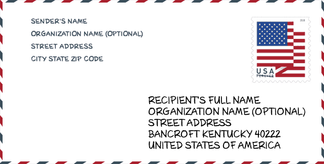
Envelope Example

This is an example of a US zip envelope. You can use a 5-digit zipcode or a detailed 9-digit zipcode to copy the mail in the following address format.
40222 Basic Meaning
What does each digit of ZIP Code 40222 stands for? The first digit designates a national area, which ranges from zero for the Northeast to nine for the far West. The 2-3 digits are the code of a sectional center facility in that region. The last two digits designate small post offices or postal zones.

Online Map

This is online map of the address Thornhill, Kentucky, United States. You may use button to move and zoom in / out. The map information is for reference only.
University

This is the ZIP Code 40222 - University page list. Its detail university Name, Street, City, State, ZIP Code, Phone is as below.
| Name | Street | City | State | ZIP Code | Phone |
| Paul Mitchell the School-Louisville | 156 North Hurstbourne Parkway | Louisville | KY | 40222 | (502) 583-1018 |
Museum

This is the ZIP Code 40222 - Museum page list. Its detail Museum Name, Street, City, State, ZIP Code, Phone is as below.
- Name: BEARGRASS ST MATTHEWS HISTORICAL SOCIETY
- Street: 9200 SHELBYVILLE RD STE 611
- City: LOUISVILLE
- State: KY
- ZIP Code: 40222
- Phone: (502) 899-2524
Library

This is the ZIP Code 40222 - Library page list. Its detail Library Name, Address, City, State, ZIP Code, Phone is as below.
- Name: WESTPORT BRANCH
- Address: 8100 WESTPORT ROAD - SUITE B
- City: LOUISVILLE
- State: KY - Kentucky
- ZIP Code: 40222
- Phone: (502) 394-0379
School
This is the ZIP Code 40222 - School page list. Its detail School Name, Address, City, State, ZIP Code is as below.
| School Name | Address | City | State | Grades | ZIP Code |
|---|---|---|---|---|---|
| Wilder Elementary | 1913 Herr Lane | Louisville | KY | UG | 40222 |
| Westport Middle | 8100 Westport Road | Louisville | KY | UG | 40222 |
| Ballard High | 6000 Brownsboro Road | Louisville | KY | UG | 40222 |
| Lowe Elementary | 210 Oxfordshire Lane | Louisville | KY | UG | 40222 |
| The Phoenix School of Discovery | 502 Wood Rd | Louisville | KY | UG | 40222 |
Population for ZIP Code 40222

What is the total population in ZIP Code 40222? Below is detail information.
- Population for ZIP Code 40222: 22,716
- 2010 Population: 21,359
The 2020 demographic statistics are in progress. The current population in ZIP code 40222 is 22,716, and the population in 2010 is 21,359.
Gender

In all the statistical population, the male population is 10,111, the female population is 11,248.
- Male Population: 10,111
- Female Population: 11,248
Race

In all the statistical population, the male population is 10,111, the female population is 11,248.
- White Population: 18,474
- Black Population: 1,764
- Hispanic Population: 894
- Asian Population: 1,036
- Hawaiian Population: 16
- Indian Population: 100
- Other Population: 401
Age

In all the statistical population, the White population is 18,474, the Black population is 1,764, the Hispanic population is 894, the Asian population is 1,036, the Hawaiian population is 16, the Indian Ppopulation is 100 and Other population is 401.
- Age's Median: 41.8
- Median of male age: 39.0
- Median of female age: 44.5
Households for ZIP Code 40222
ZIP code 40222 has 9,898 households, with an average number of 2.09 persons per household. The average income per household in Zip code 40222 is 73,220 USD, and the average house value is 258,000 USD.
- Households Per Zipcode: 9,898
- Persons Per Household: 2.09
- Average House Value: 258,000
- Income Per Household: 73,220
Geographic

The latitude of the Zip code 40222 is 38.277963, the longitude is -85.626869, and the elevation is 596. It has land area of 10.437 square miles, and water area of 0.945 square miles. The time zone for ZIP code 40222 is Eastern (GMT -05:00). Daylight saving time should be observed in the area where the zip code is located.
- Latitude: 38.277963
- Longitude: -85.626869
- Elevation: 596
- Land Area: 10.437
- Water Area: 0.945
- Time Zone: Eastern (GMT -05:00)
- Region: South
- Division: East South Central
- Day Light Saving: Y
Congressional District

The Congressional District for ZIP code 40222 is Kentucky's 3rd congressional district, the Congressional Land Area is 319.34 square mile.
- Congressional District: 3rd
- Congressional Land Area: 319.34
Delivery

In the ZIP code 40222, there are 10,869 residential delivery mailboxes and centralized units, and 1,238 commercial delivery mailbox and centralized units, 6,730 single family deliveries and 3,339 multifamily deliveries, and the box count is 11,792. The main post office has city delivery carrier routes for the ZIP code 40222.
- Delivery Residential: 10,869
- Delivery Business: 1,238
- Delivery Total: 11,792
- Single Family Delivery Units: 6,730
- Multi Family Delivery Units: 3,339
- City Delivery Indicator: Y
Business

In ZIP code 40222, the number of business is 1,158, the number of employee is 29,329, the business first quarter payroll is 443,420,000 USD, the business annual payroll is 1,567,939,000 USD.
- Number Of Businesses: 1,158
- Number Of Employees: 29,329
- Business First Quarter Payroll: 443,420,000
- Business Annual Payroll: 1,567,939,000
Social Security Benefits

There are 4,660 beneficiaries with benefits in current-payment status for ZIP code 40222, of which 3,530 are retired workers, 315 are disabled workers, 315 are widow(er)s and parents, 225 are spouses and 275 are children. The number of beneficiaries aged 65 or older is 3,990. The total monthly benefits are 7,517,000 USD, of which 6,088,000 USD for retired workers, 526,000 USD for widow(er)s and parents.
- Total Number: 4,660
- Retired workers Number: 3,530
- Disabled workers Number: 315
- Widow(er)s and parents Number: 315
- Spouses Number: 225
- Children Number: 275
- All beneficiaries per month: 7,517,000
- Retired workers per month: 6,088,000
- Widow(er)s and parents per month: 526,000
- Number of beneficiaries aged 65 or older: 3,990


Add new comment