United States ZIP Code: 41653
This is the Kentucky ZIP Code 41653 page list. Its detail State, County, City, Longitude, Latitude, Envelope Example, Population is as below.

ZIP Code 41653 Information

-
-
Country:
U.S. - United States
State:
State FIPS:
21
Area Code:
ZIP Code:
41653
ZIP Type:
S (Standard)
❓What does S (Standard) mean? A "standard" ZIP Code is what most people think of when they talk about ZIP Codes - essentially a town, city, or a division of a city that has mail service.
ZIP Code 41653 - City

This is the city information corresponding to 41653:
| State | County | City | City Type ?In many cases, a ZIP Code can have multiple "names", meaning cities, towns, or subdivisions, in its boundaries. However, it will ALWAYS have exactly 1 "default" name. D - Default - This is the "preferred" name - by the USPS - for a city. Each ZIP Code has one - and only one - "default" name. In most cases, this is what people who live in that area call the city as well. A - Acceptable - This name can be used for mailing purposes. Often times alternative names are large neighborhoods or sections of the city/town. In some cases a ZIP Code may have several "acceptable" names which is used to group towns under one ZIP Code. N - Not Acceptable - A "not acceptable" name is, in many cases, a nickname that residents give that location. According to the USPS, you should NOT send mail to that ZIP Code using the "not acceptable" name when mailing. | ZIP Code |
|---|---|---|---|---|
| KY | Floyd | Bonanza | N (Not Acceptable) | 41653 |
| KY | Floyd | Cliff | N (Not Acceptable) | 41653 |
| KY | Floyd | Dock | N (Not Acceptable) | 41653 |
| KY | Floyd | Emma | A (Acceptable) | 41653 |
| KY | Floyd | Endicott | A (Acceptable) | 41653 |
| KY | Floyd | Hippo | A (Acceptable) | 41653 |
| KY | Floyd | Lancer | N (Not Acceptable) | 41653 |
| KY | Floyd | Prestonsburg | D (Default) | 41653 |
| KY | Floyd | Sloan | N (Not Acceptable) | 41653 |
| KY | Floyd | Watergap | N (Not Acceptable) | 41653 |
❓What does D (Default) mean? This is the "preferred" name - by the USPS - for a city. Each ZIP Code has one - and only one - "default" name. In most cases, this is what people who live in that area call the city as well.
❓What does A (Acceptable) mean? This name can be used for mailing purposes. Often times alternative names are large neighborhoods or sections of the city/town. In some cases a ZIP Code may have several "acceptable" names which is used to group towns under one ZIP Code.
❓What does N (Not Acceptable) mean? A "not acceptable" name is, in many cases, a nickname that residents give that location. According to the USPS, you should NOT send mail to that ZIP Code using the "not acceptable" name when mailing.
ZIP Code 41653 Plus 4
ZIP Code 5 plus 4 is the extension of 5-digit zip code, It can be used to locate a more detailed location. The last four digits designate segment or one side of a street or an apartment. You can find the ZIP+4 code and corresponding address of the zip code 41653 below.
| ZIP Code 5 Plus 4 | Address |
|---|---|
| 41653-0001 | PO BOX 1, PRESTONSBURG, KY |
| 41653-0121 | PO BOX 121, PRESTONSBURG, KY |
| 41653-0241 | PO BOX 241, PRESTONSBURG, KY |
| 41653-0361 | PO BOX 361, PRESTONSBURG, KY |
| 41653-0481 | PO BOX 481, PRESTONSBURG, KY |
Envelope Example

This is an example of a US zip envelope. You can use a 5-digit zipcode or a detailed 9-digit zipcode to copy the mail in the following address format.
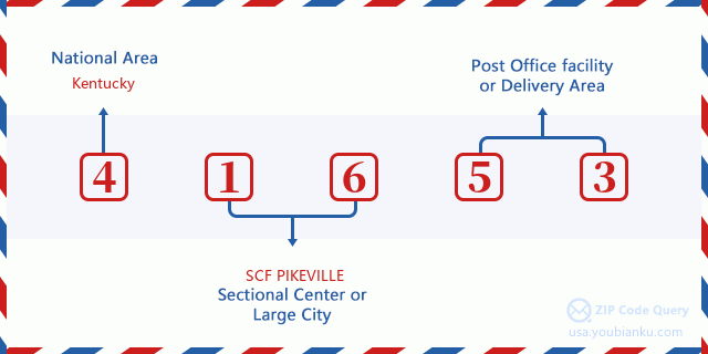
41653 Basic Meaning
What does each digit of ZIP Code 41653 stands for? The first digit designates a national area, which ranges from zero for the Northeast to nine for the far West. The 2-3 digits are the code of a sectional center facility in that region. The last two digits designate small post offices or postal zones.
Online Map

This is online map of the address Watergap, Kentucky, United States. You may use button to move and zoom in / out. The map information is for reference only.
University

This is the ZIP Code 41653 - University page list. Its detail university Name, Street, City, State, ZIP Code, Phone is as below.
| Name | Street | City | State | ZIP Code | Phone |
| Big Sandy Community and Technical College | 1 Bert Combs Dr | Prestonsburg | KY | 41653 | (606) 886-3863 x0 |
Hospital

This is the ZIP Code 41653 - Hospital page list. Its detail Hospital Name, Street, City, State, ZIP Code, Phone is as below.
- Name: HIGHLANDS REGIONAL MEDICAL CENTER
- Address: PRESTONSBURG
- City: 5000 KENTUCKY ROUTE 321
- State: KY
- ZIP Code: 41653
- Phone: (606) 886-8511
Museum

This is the ZIP Code 41653 - Museum page list. Its detail Museum Name, Street, City, State, ZIP Code, Phone is as below.
| Name | Street | City | State | ZIP Code | Phone |
| MAYHOUSE LIVING HISTORY MUSEUM | 220 E PORTER ST | PRESTONSBURG | KY | 41653 | (606) 889-9608 |
| EAST KENTUCKY SCIENCE CENTER | 1 BERT COMBS DRIVE | PRESTONSBURG | KY | 41653 | (606) 889-8260 |
| EAST KENTUCKY SCIENCE CENTER & PLANETARIUM | ONE BERT T COMBS DRIVE | PRESTONSBURG | KY | 41653 |
Library

This is the ZIP Code 41653 - Library page list. Its detail Library Name, Address, City, State, ZIP Code, Phone is as below.
| Name | Address | City | State | ZIP Code | Phone |
|---|---|---|---|---|---|
| FLOYD COUNTY LIBRARY | 161 NORTH ARNOLD AVENUE | PRESTONSBURG | KY | 41653 | (606) 886-2981 |
| FLOYD COUNTY PUBLIC LIBRARY | 161 NORTH ARNOLD AVENUE | PRESTONSBURG | KY | 41653 | (606) 886-2981 |
School
This is the ZIP Code 41653 - School page list. Its detail School Name, Address, City, State, ZIP Code is as below.
| School Name | Address | City | State | Grades | ZIP Code |
|---|---|---|---|---|---|
| Prestonsburg High School | 825 Blackcat Boulevard | Prestonsburg | KY | UG | 41653 |
| James D. Adams Middle School | 2520 S Lake Dr | Prestonsburg | KY | UG | 41653 |
| Prestonsburg Elementary School | 140 S Clark Dr. | Prestonsburg | KY | UG | 41653 |
| HOME INSTRUCTION ELEMENTARY | 106 North Front Avenue | Petersburg | KY | UG | 41653 |
| HOME INSTRUCTION H.S. | 106 North Front Avenue | Petersburg | KY | UG | 41653 |
Population for ZIP Code 41653

What is the total population in ZIP Code 41653? Below is detail information.
- Population for ZIP Code 41653: 11,134
- 2010 Population: 11,451
The 2020 demographic statistics are in progress. The current population in ZIP code 41653 is 11,134, and the population in 2010 is 11,451.
Gender

In all the statistical population, the male population is 5,635, the female population is 5,816.
- Male Population: 5,635
- Female Population: 5,816
Race

In all the statistical population, the male population is 5,635, the female population is 5,816.
- White Population: 11,234
- Black Population: 152
- Hispanic Population: 118
- Asian Population: 41
- Hawaiian Population: 6
- Indian Population: 46
- Other Population: 64
Age

In all the statistical population, the White population is 11,234, the Black population is 152, the Hispanic population is 118, the Asian population is 41, the Hawaiian population is 6, the Indian Ppopulation is 46 and Other population is 64.
- Age's Median: 40.0
- Median of male age: 38.1
- Median of female age: 42.2
Households for ZIP Code 41653
ZIP code 41653 has 4,725 households, with an average number of 2.30 persons per household. The average income per household in Zip code 41653 is 33,892 USD, and the average house value is 101,700 USD.
- Households Per Zipcode: 4,725
- Persons Per Household: 2.30
- Average House Value: 101,700
- Income Per Household: 33,892
Geographic

The latitude of the Zip code 41653 is 37.618384, the longitude is -82.754802, and the elevation is 928. It has land area of 120.008 square miles, and water area of 0.897 square miles. The time zone for ZIP code 41653 is Eastern (GMT -05:00). Daylight saving time should be observed in the area where the zip code is located.
- Latitude: 37.618384
- Longitude: -82.754802
- Elevation: 928
- Land Area: 120.008
- Water Area: 0.897
- Time Zone: Eastern (GMT -05:00)
- Region: South
- Division: East South Central
- Day Light Saving: Y
Congressional District

The Congressional District for ZIP code 41653 is Kentucky's 05th congressional district, the Congressional Land Area is 11235.15 square mile.
- Congressional District: 05th
- Congressional Land Area: 11235.15
Delivery

In the ZIP code 41653, there are 4,841 residential delivery mailboxes and centralized units, and 485 commercial delivery mailbox and centralized units, 3,901 single family deliveries and 80 multifamily deliveries, and the box count is 6,091. The main post office has city delivery carrier routes for the ZIP code 41653.
- Delivery Residential: 4,841
- Delivery Business: 485
- Delivery Total: 6,091
- Single Family Delivery Units: 3,901
- Multi Family Delivery Units: 80
- City Delivery Indicator: Y
Business

In ZIP code 41653, the number of business is 383, the number of employee is 4,361, the business first quarter payroll is 41,269,000 USD, the business annual payroll is 169,158,000 USD.
- Number Of Businesses: 383
- Number Of Employees: 4,361
- Business First Quarter Payroll: 41,269,000
- Business Annual Payroll: 169,158,000
Social Security Benefits

There are 3,120 beneficiaries with benefits in current-payment status for ZIP code 41653, of which 1,510 are retired workers, 815 are disabled workers, 315 are widow(er)s and parents, 170 are spouses and 310 are children. The number of beneficiaries aged 65 or older is 1,840. The total monthly benefits are 3,985,000 USD, of which 2,237,000 USD for retired workers, 374,000 USD for widow(er)s and parents.
- Total Number: 3,120
- Retired workers Number: 1,510
- Disabled workers Number: 815
- Widow(er)s and parents Number: 315
- Spouses Number: 170
- Children Number: 310
- All beneficiaries per month: 3,985,000
- Retired workers per month: 2,237,000
- Widow(er)s and parents per month: 374,000
- Number of beneficiaries aged 65 or older: 1,840


Add new comment